Have you ever wondered what stories the roads in Luton could tell if they could talk? Every turn, every lane, and every detour holds a glimpse of how the town has grown and changed. Whether you live here or just drive through, understanding the layout and rhythm of the roads can make a world of difference. Let’s take a proper look at what makes the roads in Luton so distinctive and what you should know before setting out.
The Heart of Luton’s Road Network
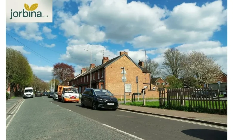
Luton’s road system is a living map of its history. Once a small market town, it has grown into a busy urban centre that connects directly to London, Dunstable, and the wider Bedfordshire area. You can see this evolution in its roads: some wide and modern, others narrow and winding. The main routes like Dunstable Road, Leagrave Road, Hatters Way, and London Road are the veins that keep the town moving. These roads link schools, homes, and businesses, and they carry thousands of vehicles every single day. According to Luton road traffic statistics, vehicle use across the town has steadily risen over the past decade. That growth puts pressure on key junctions, especially during peak hours when commuters flood toward the M1 or head across town for work.
List of Roads in Luton
The list of roads in Luton is long; over 1,400 named streets stretch across the LU1 to LU4 postcodes. You’ll find everything from short cul-de-sacs to major A-roads cutting through the town. Here are a few you’ve likely seen: Abbey Drive, Abbots Wood Road, Dunstable Road, Leagrave Road, Ashcroft Road, Stockingstone Road, Crawley Green Road, Hatters Way, and Biscot Road. These are just a handful from an extensive network that covers every corner of the town. Each road has its own rhythm, some calm and residential, others lined with shops, bus stops, or roundabouts that test your patience.
Mapping the Roads in Luton
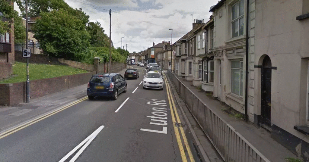
If you want a clear picture of how everything connects, it’s worth checking a road in Luton on an online map or grabbing a printed one from the local library. The town layout might surprise you. Luton’s centre sits in a valley, which means certain roads rise steeply toward areas like Stopsley and Warden Hill. It’s one reason drivers new to Luton sometimes find the routes confusing—there’s a mix of flat urban roads and unexpected inclines that can slow traffic. Navigation apps help, but even locals occasionally end up looping around St Mary’s Roundabout more than once.
Road Closures and Live Updates
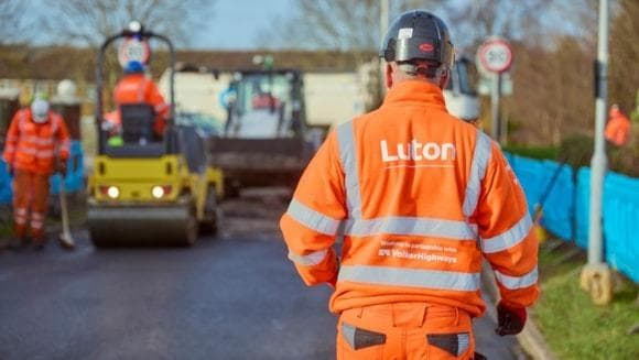
If you drive in Luton, you already know that road closures can disrupt even a short trip. Pothole repairs, water main works, or resurfacing projects pop up regularly. The council’s “Roadworks and Closures” map is the best place to check updates before heading out. A quick search for “Luton road closures today” or “Roadworks in Luton today” usually brings up the latest information on current works and diversion routes. For those planning ahead, “Road closures Luton tomorrow” looks at upcoming restrictions, so you can plan an alternative path before you leave home. These closures don’t just affect Luton’s town centre; they often ripple out to neighbouring areas like Dunstable, where “Road closures in Dunstable today map” will show which connecting roads are blocked. One night of resurfacing on Dunstable Road or Hatters Way can easily add 15 to 20 minutes to your commute.
The Bigger Picture: Why Closures Happen
Every closure or detour in Luton has a reason, though it doesn’t always feel that way when you’re stuck in traffic. Sometimes it’s a simple resurfacing job; other times it’s major infrastructure work tied to new developments or transport upgrades. It’s all part of keeping the roads safe and functional for the long term. If you think Luton has it rough, just look at the Watford A41 Road Closure Travis Perkins Disrupts Local Traffic incident, a good reminder that even short-term works can cause widespread disruption when they hit the wrong junction.
Planning Your Route
Here’s where good planning comes in. Before you leave, check live traffic updates from your preferred navigation app. Combine that with the council’s roadworks page for real-time alerts. Avoid peak rush hours around key roads like the A505 and Dunstable Road if you can. If closures are listed, use Hatters Way or Airport Way as alternatives, depending on your direction. Luton’s traffic tends to bottleneck near the town centre, so small timing adjustments can make a big difference. For cyclists and pedestrians, use side routes and avoid areas with active works whenever possible.
How Luton’s Roads Shape the Town
The roads in Luton aren’t just about transport; they shape how people interact with the town. Hatters Way, for instance, isn’t just a convenient route; it’s a symbol of local heritage, named after the town’s famous hat-making industry. The A505 links Luton Airport with the surrounding areas, connecting business travellers, tourists, and residents every day. Dunstable Road is another artery that ties the old and new parts of town together. Each of these routes carries its share of local stories, from morning rush hours to weekend drives toward the countryside.
Roadworks in Luton Today
Checking roadworks updates daily is more useful than it sounds. A single closure can cause major diversions, and knowing about it early saves time and stress. The Luton Borough Council regularly posts live notices about resurfacing or utility works, including how long they’ll last. If you live near an affected street, you’ll usually receive a warning through a letter or signpost. Even so, not everyone notices until the barriers go up and the diversions begin. That’s why checking the “Luton road closures map” every few days is a smart habit.
Road Closures in Dunstable Today Map
Dunstable is Luton’s close neighbour, and their road networks overlap more than you might think. Closures in one area often affect the other, especially along shared routes like the A505 or Dunstable Road. When a section in Dunstable shuts down, traffic diverts through Luton almost immediately. If you commute between the two, check the Road closures in Dunstable today map to see what’s blocked. It’s a small step that helps avoid being caught off guard.
The Future of Roads in Luton
Luton’s growing population means more vehicles, which puts ongoing strain on the road system. The council continues to invest in road resurfacing, better signage, and smarter traffic management. You’ll see this in newly laid sections of Crawley Green Road or the updated roundabouts on the A6 corridor. These projects might cause short-term inconvenience, but they’re aimed at making travel smoother in the long run. The hope is to strike a balance: roads that can handle increased traffic without losing accessibility for cyclists, buses, and pedestrians.
What Locals Say About the Roads in Luton
Ask around and you’ll hear mixed reviews. Some people praise how easy it is to get from one end of town to the other; others grumble about endless works and confusing junctions. Both views are fair. Luton’s geography and constant development mean the road system is in a near-constant state of change. Still, with better planning tools and live updates, driving around town has become more manageable.
FAQs
What are the rough areas of Luton?
Like any town, Luton has areas that are busier or more run-down than others. The term “rough” often reflects perception rather than fact. Areas near the centre experience more congestion, while suburban zones like Barton Hills or Bushmead tend to be quieter.
How many roads are in Luton?
There are over 1,400 recorded roads in Luton, spanning residential, industrial, and major routes. The exact number shifts as new estates are built and old roads are renamed or merged.
What is Luton famous for?
Luton is known for its hat-making history, diverse culture, and London Luton Airport. It’s also home to Luton Town FC, affectionately called “The Hatters”, tying back to that same heritage.
What is the best area to live in Luton?
If you value quick access to major roads and public transport, Stopsley, Leagrave, and Bushmead are solid options. They offer balance, good schools, local shops, and relatively smooth access to the town’s main routes.
Which UK city has the worst crime rate?
That depends on the category and data source. Some major cities like Birmingham or Manchester often appear at the top for certain crime types, but context matters. What’s clear is that Luton, like many towns, focuses heavily on safety improvements, both on and off the road.
Final Thoughts
The roads in Luton tell a story of change, resilience, and movement. They carry the rhythm of daily life, from early-morning commutes to late-night returns home. Yes, the closures can be frustrating, and the traffic can test your patience, but the town continues to invest in making travel better. If you take one thing from this guide, let it be this: plan before you drive, stay updated on live roadworks, and appreciate how every lane and junction plays a part in keeping Luton connected.